
Walking the Nakasendo: Japan’s Ancient Highway Through the Mountains
“I didn’t plan to walk the Nakasendo. I didn’t even know it existed. But some paths find you before you find them.”
I didn’t plan to walk the Nakasendo. I didn’t even know it existed.
One minute I was scrolling on my phone in Australia, and the next I was watching an Instagram video that felt like a window to another century — stone-paved streets, cedar forests, wooden houses that looked like they hadn’t changed in four hundred years. In fact, before I’d even finished watching it, I’d already sent it to my friend. We have a pact, the two of us. Every year, a walking trail holiday. No discussion was needed. We were going to Japan.
Japan had been on my list for years — one of those places everyone raves about that I somehow never got around to visiting. This felt like the perfect reason. Not the temples or the food or the bullet trains (though all of that was coming too). This was something different. A chance to walk through the historical heart of a country I didn’t yet know, far from the tourist circuits, on a road that samurai and pilgrims and merchants had walked for centuries before me.
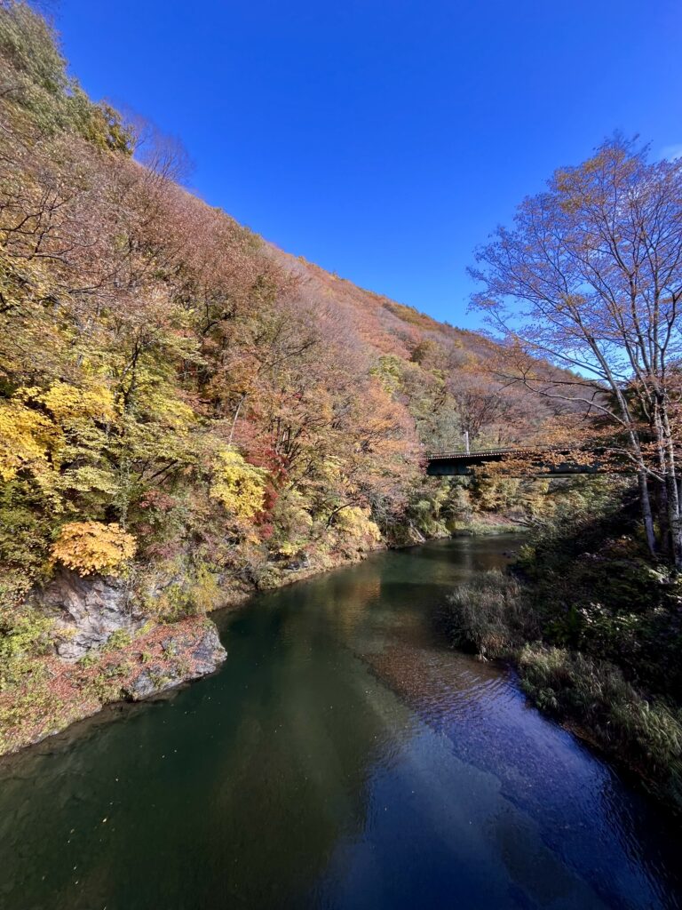
We chose early November. The Kiso Valley in autumn is something I genuinely didn’t have words for when I was standing in it. Crimson, gold, amber — the whole valley was on fire with colour, and the air had that particular crispness that makes you feel more awake than usual. More present. Like your body knows it’s somewhere worth paying attention to.
A bit of history (because it matters)
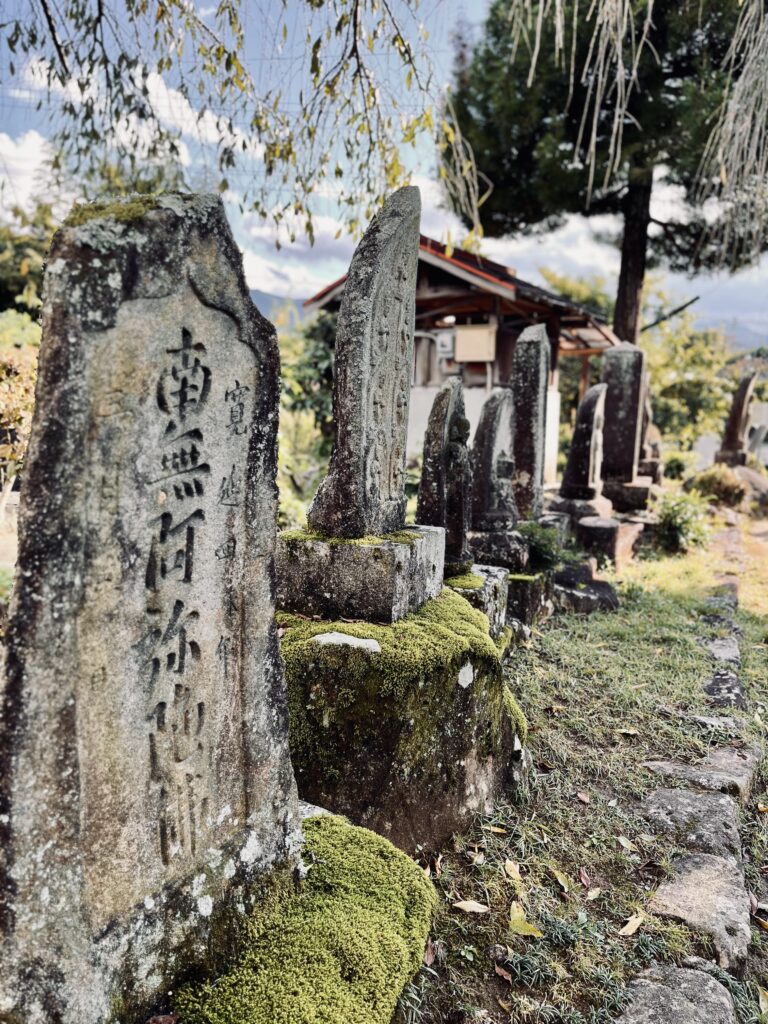
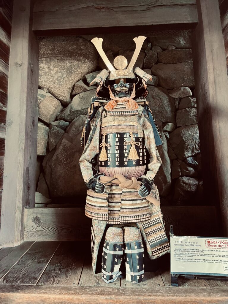
The Nakasendo — which translates as the Central Mountain Route — is a 534-kilometre historic highway that once connected Kyoto and Edo, which is modern-day Tokyo, through the inland mountains of Japan. It was formalised by the Tokugawa shogunate in the early 1600s as one of five official travel routes used to control and govern the country. Along the way, 69 post towns — called shukuba-machi — were established at regular intervals, providing lodging, food, and fresh horses for official travelers. They became prosperous hubs for merchants, pilgrims, and samurai alike.
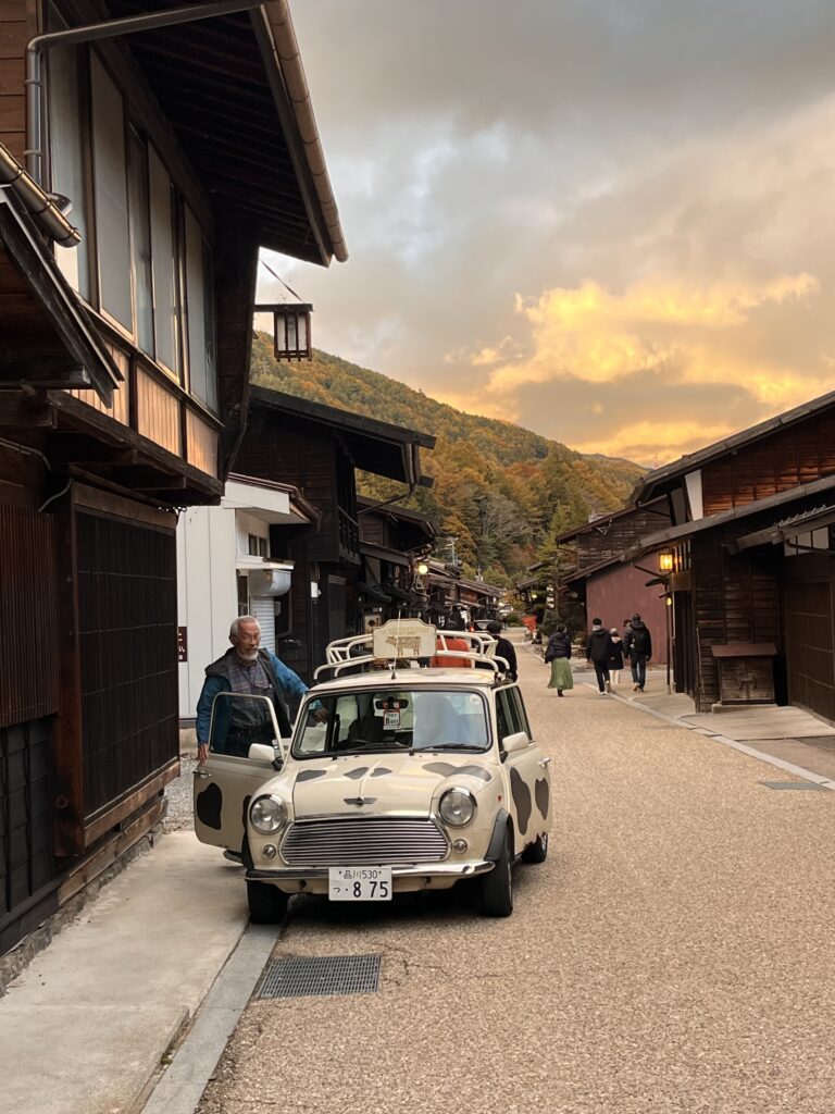
After the Edo period ended, railways and modern roads made much of the trail obsolete. However, the remoteness of the Kiso Valley meant its post towns were spared from major development. As a result, local residents later led preservation movements to restore towns like Magome, Tsumago, and Narai — and today they are some of Japan’s best-preserved Edo-period settlements. Walking through them, you feel it. These aren’t reconstructions. They’re the real thing.
How we did it: 4 days through the Kiso Valley
Most people who walk the Nakasendo focus on the Kiso Valley section — and for good reason. This is where the magic is. Here’s how our five days went.
Day 1 — Nakatsugawa to Magome
We arrived into Nakatsugawa by train from Nagoya and made a decision that immediately set the tone for the whole trip. Most people take the direct bus to Magome, the popular trailhead about 25 minutes away. But I found a detailed trail map at the station tourist information centre and realised we could walk from the town itself — following the preserved section of the original stone-paved Nakasendo road that begins just ten minutes from the station.
It wasn’t a wilderness hike. It was a walk through living history, through the preserved streets of Nakatsugawa-juku, the 45th post town of the Nakasendo, and then along a quiet paved route toward Magome. It added about three hours to our day. I’m so glad we did it. It connected us to the trail from its very first step, in a working town, before the tourists and the cobblestones and the picture-perfect views had even begun.
Day 2 — Magome to Kiso-Fukushima
If you walk only one section of the Nakasendo, walk this one.
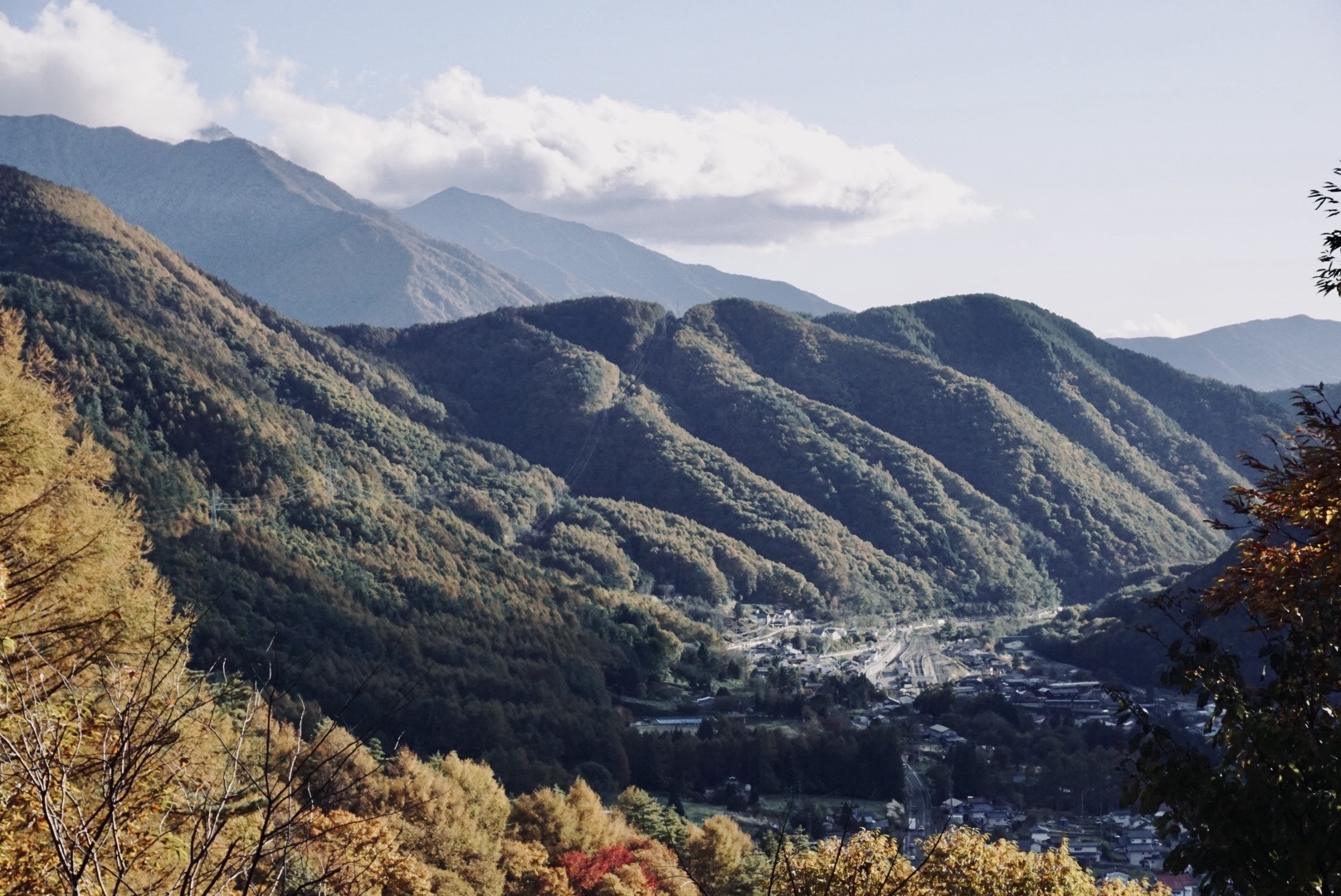
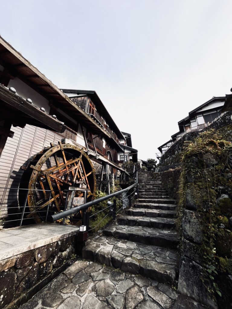
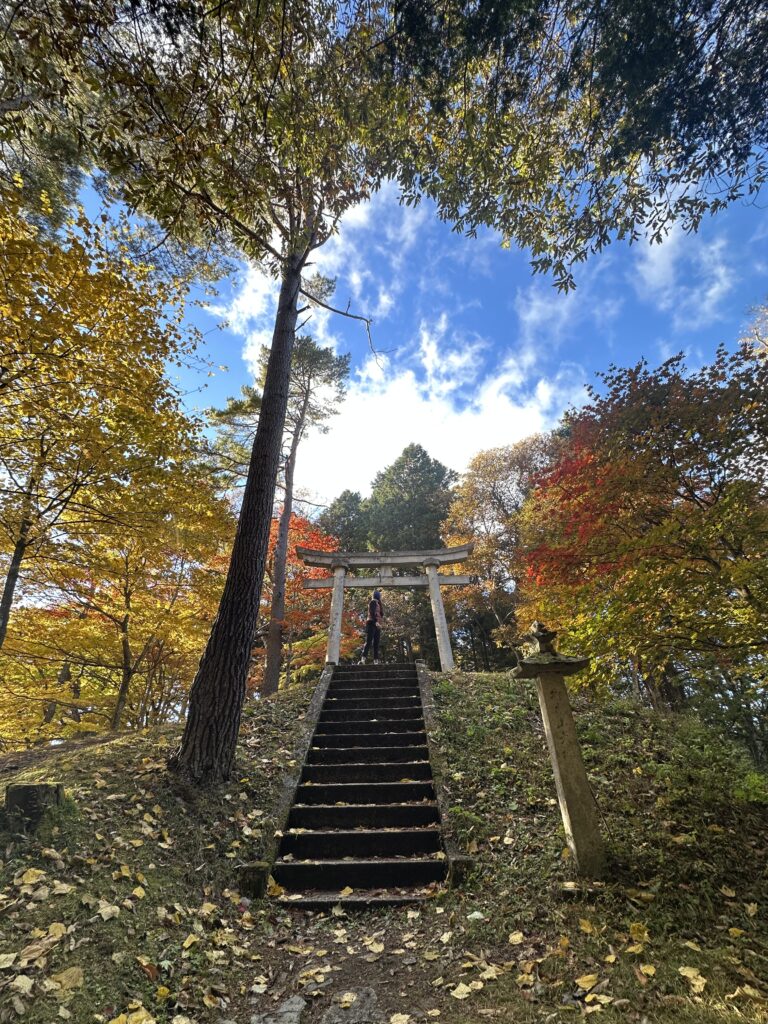
Waking up in Magome — a meticulously restored Edo-period post town built on a steep stone-paved slope — to the sound of water wheels turning and small canals flowing. We had breakfast at HillBilly Coffee Company, a cosy little café that opens at 8:30am before the tour buses arrive, then climbed the main street past traditional shops to the Magome Jinbakami Observatory Deck at the top. The view across the Kiso Valley from up there is the kind that makes you stop talking.
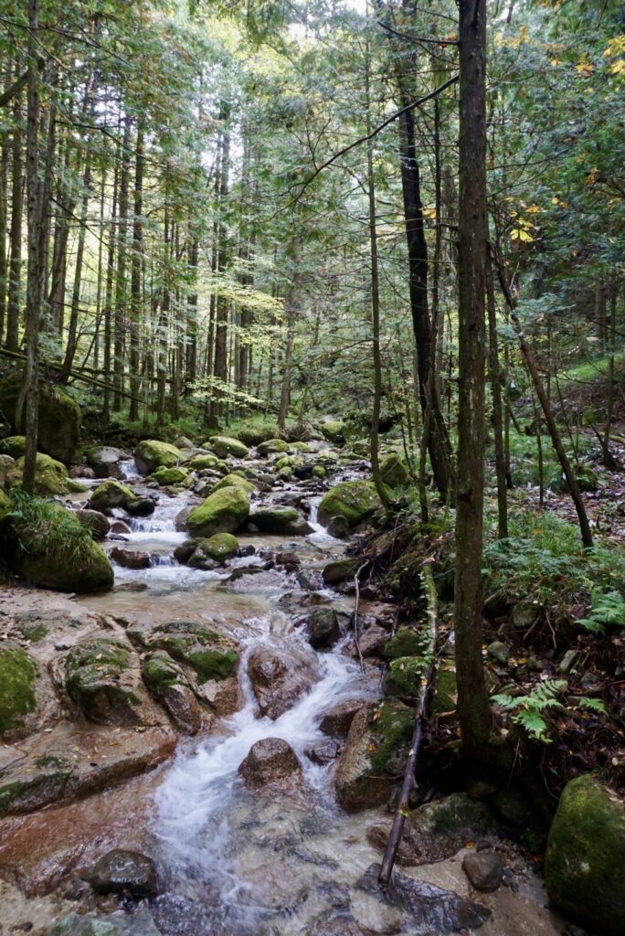
The forest path to Tsumago begins with a bear bell at the trailhead — an irresistible bell, the sign says, that you ring to announce your departure from the modern world. That bell became the soundtrack of our day, echoing from backpacks all along the trail as fellow walkers jangled through cedar forests, past wooden farmhouses, and through gardens so intimate you felt you were walking through someone’s private backyard.
Halfway along the path, we stopped at the Odaki and Medaki waterfalls — the Male and Female falls — where the forest opened up into something lush and completely still. Shortly after, just when our legs were starting to feel it, we found the Tateba Tea House: a 300-year-old rest stop where weary walkers are still offered a free cup of tea. Some things don’t need to change.
The descent into Tsumago takes you through towering cedar and bamboo forests that feel like a cathedral. The town itself is Japan’s first officially preserved historic district — no cars, no visible power lines, no modern intrusions. You arrive through the trees and suddenly you’re in the Edo period. The journey ends with the ring of another bear bell at the town entrance, marking your safe arrival.
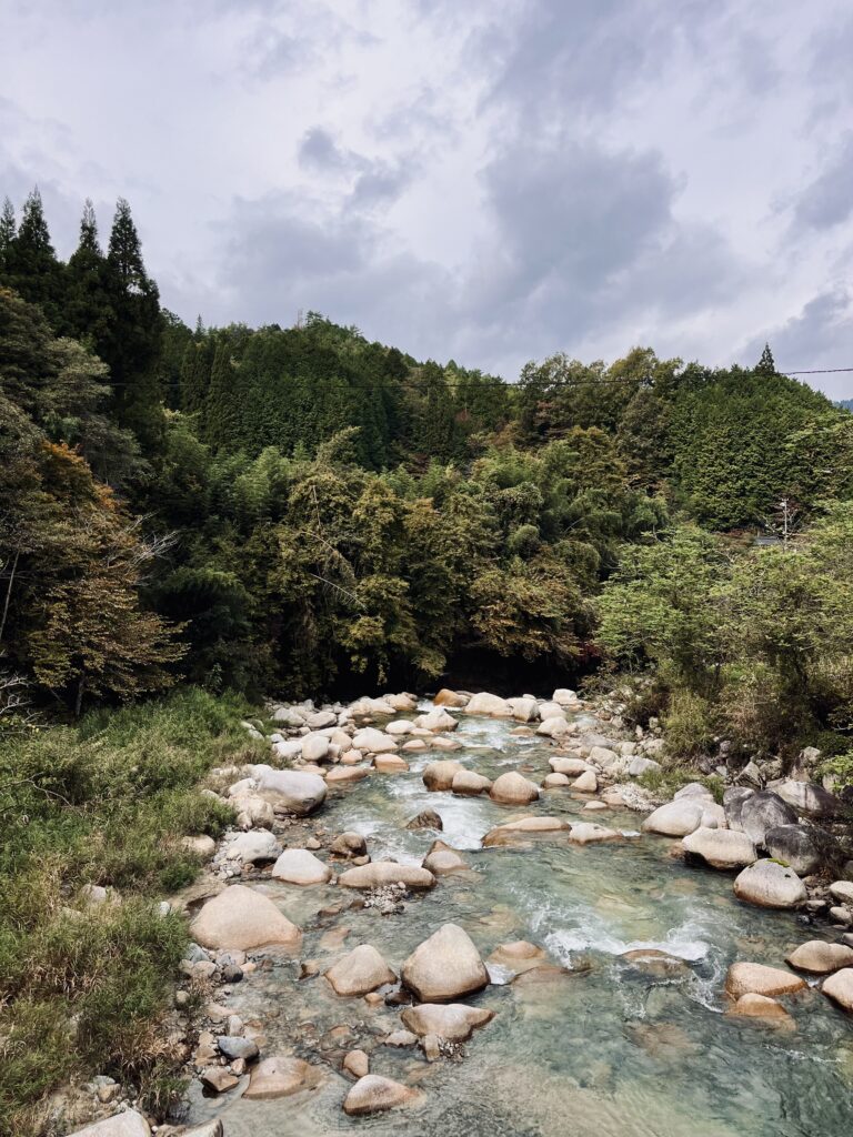
We finished the walking section at the sleepy, almost-forgotten post town of Nagiso, then caught the train to Kiso-Fukushima — the administrative checkpoint town of the Nakasendo, where a major government barrier once controlled all movement through the valley. Notably, there’s still a free public footbath by the Kiso River near Gyonin-bridge.
Day 3 — Kiso-Fukushima to Narai
This was the day that broke us open a little bit.
Most people take a short train ride from Kiso-Fukushima to Yabuhara to begin the day’s hiking, skipping the first stretch. We walked the whole thing. It was a long day — alternating between quieter forest paths and sections that ran close to the modern highway — but it was worth it for what came next.
From Yabuhara, the trail climbs steeply to the Torii Pass, known as Torii Toge, at 1,197 metres. It is the second-highest point on the entire Nakasendo. The path up is ancient stone through deep, peaceful forest, and the effort earns you a view at the top where, on a clear day, you can see the sacred Mount Ontake in the distance — the same mountain that pilgrims once walked this very road to reach.
The descent is gentler, and it brings you eventually to Narai-juku: the post town of a thousand houses. A beautifully preserved kilometre-long street of wooden buildings, shops, and cafes. We arrived tired and a little undone by the day and it felt exactly like the reward it was supposed to be.
Day 4 — Matsumoto
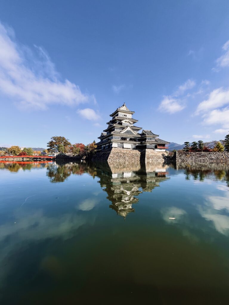
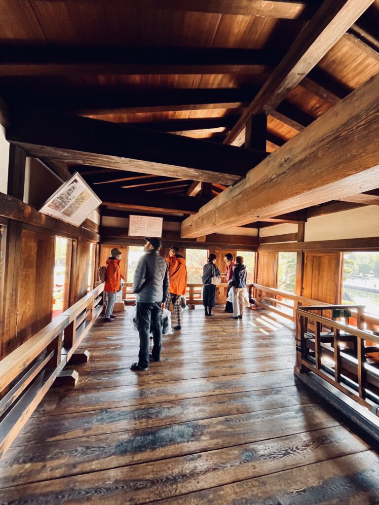
We finished the trail in Narai and caught the train to Matsumoto, a vibrant castle city at the end of the JR Chuo Line. Matsumoto Castle is one of Japan’s few completely original castles — not a reconstruction — and its striking black exterior has earned it the nickname Crow Castle. After four days of forest paths and post towns, sitting in a city felt very strange and very welcome at the same time.
Is it right for beginners?
I want to be honest with you here, because this site is built on honesty.
The Nakasendo is not a beginner trail in the sense of being flat and easy. There are long days, real elevation, and sections with no shortcuts. Day 3 at 18.4km and Day 4 at 20km will ask something of your body, especially with a pack on your back.
But here’s what I’d say to anyone who’s hesitating: this trail is deeply kind. It is well-marked, well-serviced, and full of places to rest, eat, and soak your feet in hot springs. You do not need to be a seasoned hiker. You need to be someone who can walk, who can be present, and who is willing to let a path that’s been walked for four centuries do what it has always done.
The trail will hold you. You just have to start.
The practical stuff
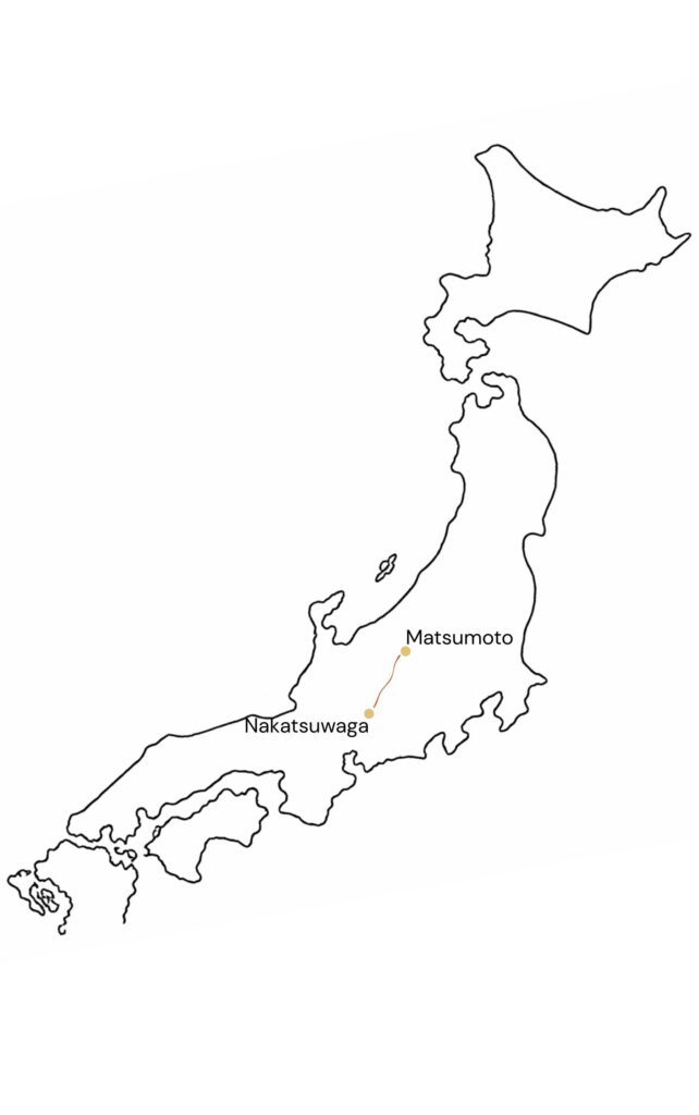
Getting there from Australia: Fly to Tokyo or Osaka, take the Shinkansen bullet train to Nagoya (1.5–2 hours from Tokyo, 50–60 minutes from Osaka/Kyoto), then transfer to the JR Chuo Line toward Nakatsugawa (about 50 minutes, around AUD $30).
Japan Rail Pass: Worth calculating for your full itinerary. A 7-day pass costs around AUD $500. Note it doesn’t cover the fastest Nozomi Shinkansen services.
Best time to go: April–May for spring, or July–November for clear walking weather. Autumn foliage peaks mid-October to early November — which is when we went, and I’d do it again in a heartbeat.
Avoid: June to early July (rainy season) and December to March (cold, possible snow on the passes).
Where to stay: Book ryokans and minshuku well in advance — months ahead if you’re going in autumn. Staying overnight in the post towns is not optional, it’s the whole point. The multi-course kaiseki dinners served at Tsumago inns, featuring local river fish and mountain vegetables, were among the best meals of the trip. Accommodation ranges from around AUD $65 for a budget guesthouse up to AUD $180+ for a historic ryokan.
Cash: Bring plenty of Japanese Yen. Many small inns, local shops, and buses don’t accept cards.
Pack: Light. Backpacks only — historic inns have no elevators and steep staircases. Comfortable shoes are everything. Get a Suica or Pasmo transport card for trains and buses. Download Google Maps offline before you leave the city.
Luggage forwarding: The Yamato Transport Takkyubin service lets you send your bags ahead to your next stop. It is an absolute game-changer.
One last thing
At the end of the trip, sitting in Matsumoto with a matcha latte (our very Western indulgence after every long day).
This trail was about paying attention. To the path. To the person walking next to you. To the fact that you are moving through something that has held millions of footsteps before yours, and will hold millions more after.
The Nakasendo doesn’t care where you started. It just asks you to walk.
Arigatou